An early tease of fall will descend on the western Prairies this weekend as cooler temperatures and high-elevation snow creeps into the forecast.
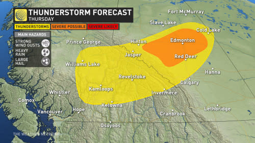
The abrupt change won’t arrive smoothly, of course, as a risk for thunderstorms over parts of central Alberta on Thursday night continues into the wee hours of Friday.
Thursday night
Areas: Edmonton and surrounding areas
Timing: Overnight Thursday into early Friday morning
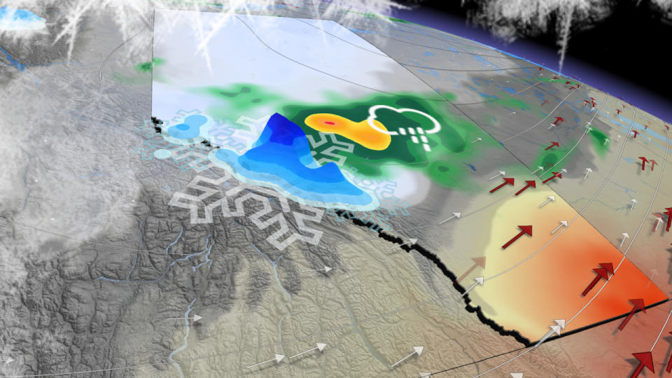
Weather: The cold front responsible for the impending cooldown will continue pushing through Alberta as we make our way toward Friday.
We’re on the lookout for strong to severe thunderstorms in and around the Edmonton area heading through the overnight Thursday into the early morning hours Friday.
Some of the storms could turn severe and produce strong wind gusts, large hail, and heavy rainfall. These punchy storms could continue past midnight, providing quite the show for anyone up late.
Thursday night’s activity is a prelude to the interesting Friday on tap across the province.
Friday
Areas: The southern half of Alberta, including the foothills and Rockies
Timing: Through the afternoon and evening hours

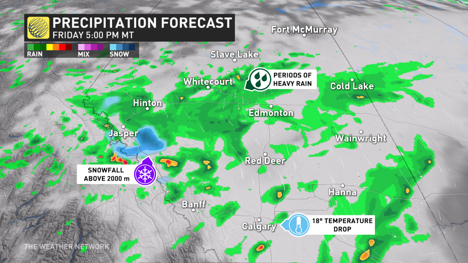
Weather: Conditions will change in a hurry Friday as our cold front sags south through Alberta, ushering in a chilly, fall-like cooldown. Temperatures on Friday will come in 10 to 15 degrees cooler than they did on Thursday for most folks across the province.
Daytime highs will struggle to reach the teens in Jasper, which would be some of the coldest temperatures recorded here since early July. Freezing levels will also plummet along the Rockies, allowing for snow to fall above 2000 m.
Meanwhile, across the southeast, warm temperatures and dry conditions will hold on for just one more day. This contrast between fall-like weather to the north and warmer air to the south will lead to a risk for thunderstorms along the cold front during the day Friday.
Rain will linger around Hinton and the surrounding areas, where more than 50 mm of rain could fall in spots by Saturday. The heaviest rainfall totals could lead to localized flooding.
Unfortunately, little rainfall is expected from this event across southern Alberta, where it’s needed the most.
Stay with The Weather Network for all the latest on conditions across Alberta.
WATCH: Calgary steps up for wildfire evacuees from N.W.T. helping thousands
*****
Credit belongs to : ca.news.yahoo.com


