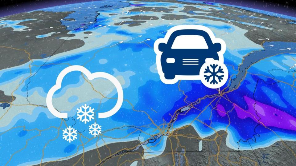
It’s bad enough to contend with a more than 15-degree temperature swing over a few short days. But we’re also looking at the opportunity for the season’s first snow across portions of southern Quebec, including Montreal.
DON’T MISS: Beware: A sharp temperature drop looms for Eastern Canada
Snow in late October isn’t quite as remarkable as the fact that Montreal could see its first measurable snow before it’s even seen its first frost of the season.
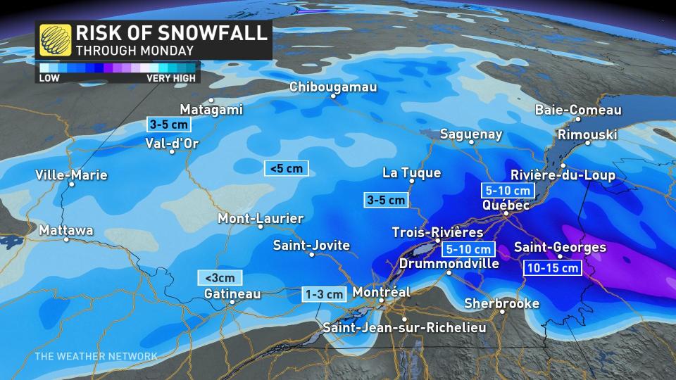
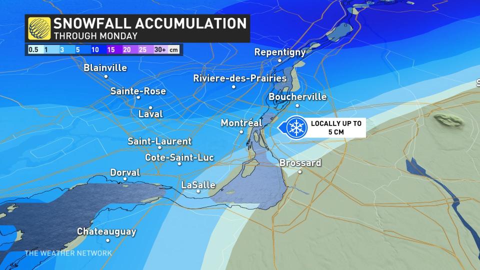
Areas adjacent to the St. Lawrence, north and south of it, as well, could see the most accumulations — anywhere from 5-15 cm will be possible.
Temperatures plunge through the weekend
A vigorous, low-pressure system marching across Canada brought a sharp taste of winter to much of the country. The week began with temperatures plunging as cold as the -20s in parts of Alberta, followed soon after by a healthy blanket of snow that swept across the Prairies.
Temperatures took a nosedive in southern Ontario to begin the weekend. Communities lurched from seeing their warmest-ever low temperatures for this late in the year on Friday to sweater weather just 24 hours later.
All that wintry weather stands in contrast with the exceptional warmth we’ve seen across the eastern half of Canada.
It’s been so unusually warm lately that Montreal hasn’t even seen its first frost yet. The coldest temperature recorded at Montreal International Airport so far this month was a 4.5°C morning back on October 13.
High temperatures will struggle to climb much above the mid-single digits through the upcoming week, with several nights likely to fall below freezing.
Not only will temperatures take a dive, but we’re on the lookout for our first flakes of the season.
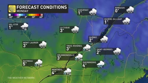
Snow possible into Monday
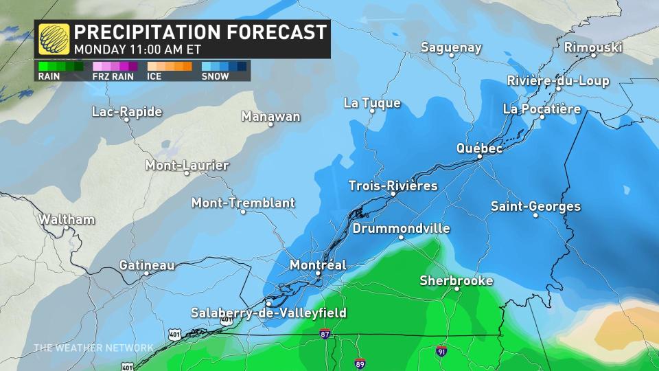
A low-pressure system developing stateside will send some of its moisture streaming north of the border, setting up the opportunity for our first dose of accumulating snow across southern Quebec.
Accumulations on solid surfaces may be a little bit tricky given how warm it’s been lately.
However, steady snows combined with subfreezing air and the serene darkness of night may allow for a modest dusting.
The areas with the best chance of seeing accumulating snow through Monday lie alongside, north and south of the St. Lawrence, including the Laurentides and Beauce and Saint-Georges, as well as Trois-Rivieres and Quebec City, where 5-15 cm of snow is possible.
Stay tuned for the latest updates for Quebec.
*****
Credit belongs to : ca.news.yahoo.com


