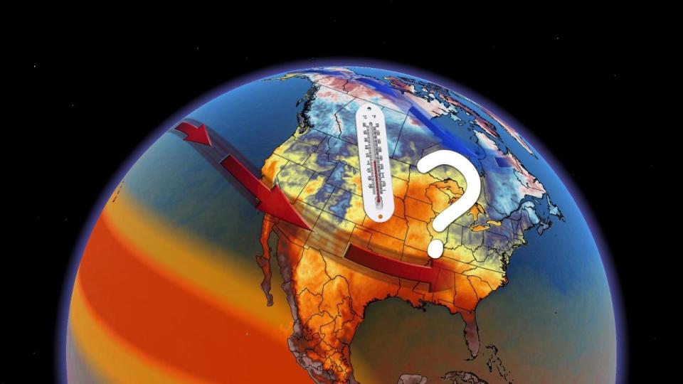
 It’s been a rough couple of weeks across the eastern half of Canada as bouts of snow and ice covered trees, snarled traffic, and even brought frigid thunderstorms. Consider next week’s pattern an atmospheric gift for dealing with the snowy, frosty weather.
A spell of above-seasonal temperatures will slide east across the country next week, starting on the Prairies before gradually inching toward the East Coast.
DON’T MISS: El Niño turns strong and still growing as winter fast approaches
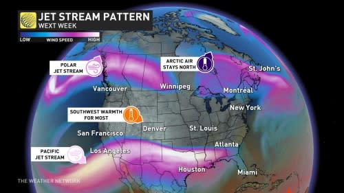
The polar jet stream that’s produced so much tumultuous weather of late will pull into Northern Canada next week, while the Pacific jet stream will remain firmly over the United States.
The resulting pattern looks conspicuously similar to the milder setup we’d expect to see heading into an El Niño winter.
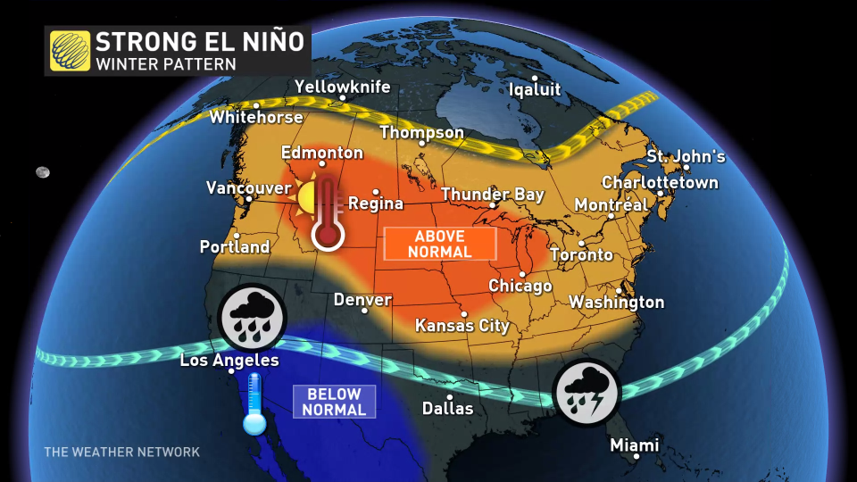 Forecasters with NOAA’s Climate Prediction Center (CPC) officially declared on Thursday that we’re in an El Niño event, and the pattern of warmer ocean waters in the Pacific could grow stronger in the weeks ahead.
We’ll see an upper-level ridge building over the Prairies early next week. Sinking air beneath a ridge allows temperatures to climb above-seasonal, and it’s a trend we’ll see all week as this ridge migrates eastward.
MUST SEE: El Niño’s impact on Canada’s winter: What to expect?
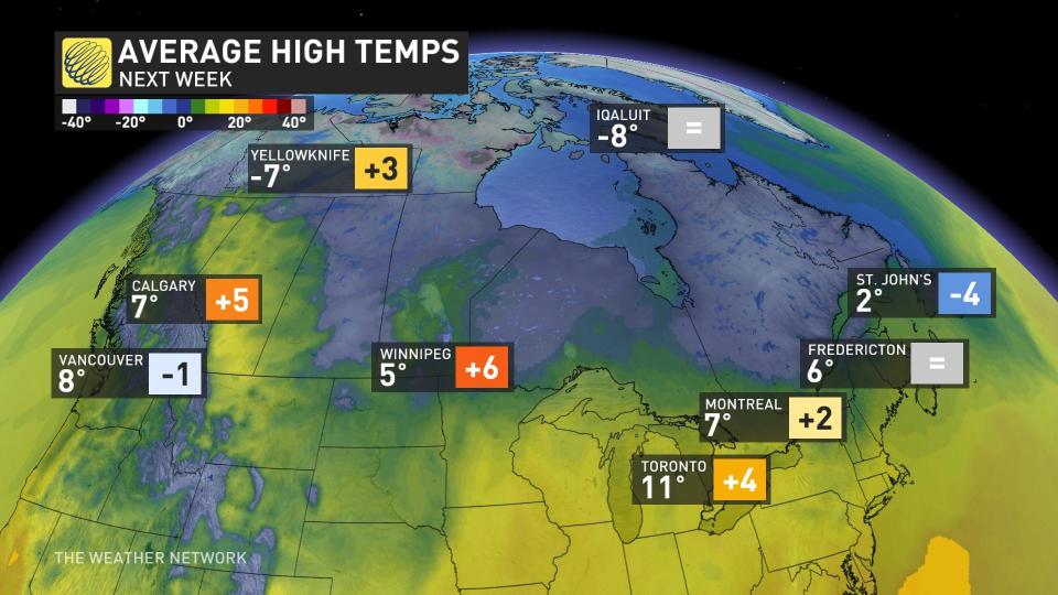
Highs will climb into the mid- to upper-single digits on the southern Prairies through the middle of next week.
As the ridge moves east, southwesterly winds will funnel above-seasonal air into Ontario. Daytime highs will reach the lower teens across southern sections of Ontario and Quebec by the end of the week, which is as much as 5 degrees above seasonal for the middle of November.
We’ll see the trend continue for the Maritimes by next weekend as daytime temperatures look to crack into the double-digits by Friday and Saturday.
Take advantage of the relative warmth while it lasts, because temperatures will likely fall back toward normal by the following week as periods of active weather return.
Stay with The Weather Network for all the latest on conditions across Canada.
WATCH: How El Niño could affect Canada’s winter weather
*****
Credit belongs to : ca.news.yahoo.com