A team of geologists, mineralogists, and Earth and ocean scientists from Canada, the United States, and France has discovered a 72-kilometer fault line on Vancouver Island in Canada that could elevate the tsunami risk for around 400,000 people.
The finding is detailed in the journal Tectonics.
Despite longstanding suspicions of seismic activity in the Georgia Basin, dense forest cover hindered research in the area.
Scientists analyzed historical data and used remote sensing, forest exploration, and shallow geophysical surveys of the Saanich Peninsula, eventually finding rock minerals that suggested magnetic field changes had occurred over time.
This indicates the rocks had been broken or pulled apart, and provided evidence of a fault line.
The 72-kilometer fault line the team uncovered, named the XEOLXELEK-Elk Lake Fault, displays a reverse dip-slip motion where rock blocks move vertically against each other.
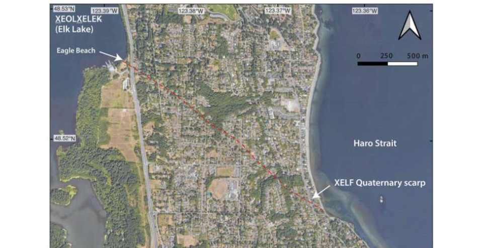
GoogleTM satellite image of the suburban region on Saanich Peninsula. The fault line is highlighted in red. (Tectonics via phys.org)
Fault poses potential risk
The fault line, which extends diagonally from northwest to southeast along the Saanich Peninsula north of Victoria, poses a potential tsunami risk due to its passage beneath the Saanich Inlet.
If an earthquake were to occur at the site of the fault line, several communites— including Victoria, Vancouver, Seattle, Bellingham, Olympia, and Tacoma— could experience the impact of a tsunami.
While the exact timing of a seismic event remains uncertain, the team estimates the last earthquake in the region, magintude 6.1-7.6, occurred approximately 2,300 to 4,700 years ago.
Next steps
Researchers plan to study the fault line further to improve earthquake safety measures.
“This newly identified fault … poses a hazard to the region’s ∼400,000 inhabitants,” the study’s authors write.
“Determining whether it produced recent large earthquakes is important for updating regional earthquake hazard models and increasing earthquake preparedness.”
RELATED: Here’s how a big earthquake could impact Vancouver
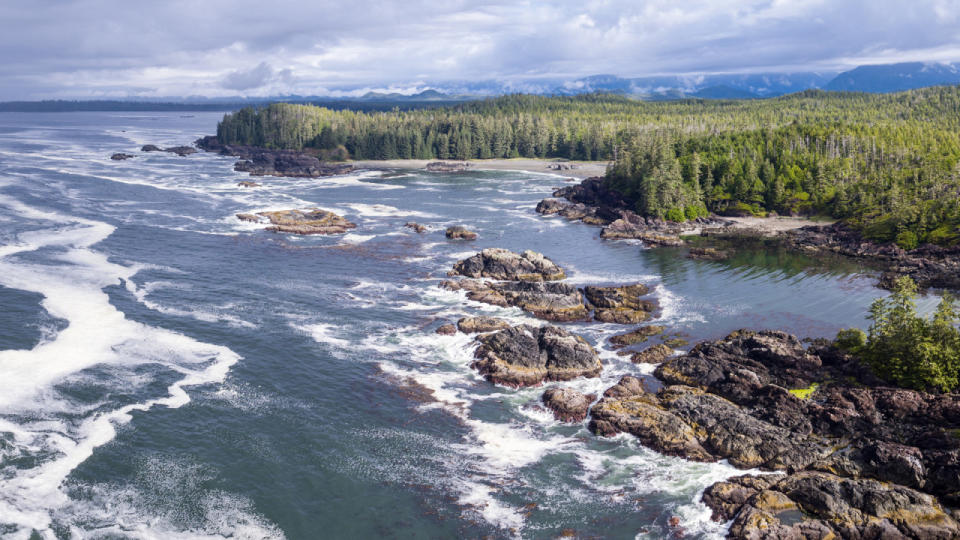
Header image: File photo of Vancouver Island courtesy of Canva Pro.
*****
Credit belongs to : ca.news.yahoo.com


