 While folks back east deal with powerful winds and potentially historic rains, a major storm scooting up the East Coast will briefly shove a bout of cooler and more seasonable air into southern Ontario to begin the week.
This could bring the coldest day of the month for many spots, including Toronto proper, where we’ll likely see a below-freezing high on Tuesday. The cold air will also kick off a round of lake-effect snow.

DON’T MISS: Frigid air on the lam in Canada as unseasonable December rolls on
Eastern Ontario is on the hook for up to 40 mm of rain from that major storm on the eastern seaboard, while the rest of southern Ontario only had to deal with clouds and occasional showers through the day Sunday.
Northwesterly winds behind that sprawling system will drag colder air down from the north, replacing our persistently mild air with readings approaching seasonable.
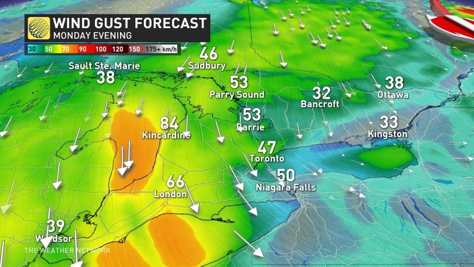 Temperatures will fall through the day Monday as gusty winds increase across the region. Gusts could reach 80 km/h along the Huron shores, while the Greater Toronto Area could see gusts of 40-60 km/h through the day.
MUST SEE: Canadian researcher cracks 135-year-old ‘unsolvable’ code
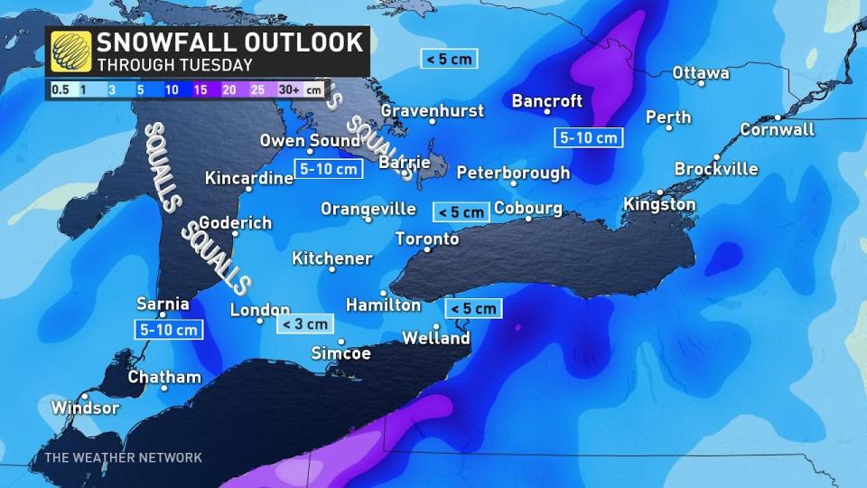 Lingering moisture from the stateside storm will combine with lake-effect snow developing in that cold air to bring a risk for light snowfall across parts of southern Ontario overnight Monday and into Tuesday morning.
Combined with the gusty winds, the snow could lead to low visibility in some areas. Plan ahead for travel delays and tricky conditions if you have to hit the road Monday night or Tuesday morning.
Snowfall accumulations will remain rather light across the region, with a dusting of less than 5 cm for most, and slightly higher totals possible near the heart of the squalls just downwind from Lake Huron and Georgian Bay.
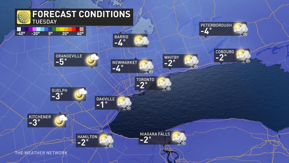
Temperatures will remain below freezing into Tuesday, marking the first time this month we’ve seen readings come in below zero degrees. This seasonable cooldown won’t last long. We’ll see a return of mild air pushing in later next week.
Stay with The Weather Network for the latest on conditions across Ontario.
*****
Credit belongs to : ca.news.yahoo.com