 A monster-sized jet stream is about to take a ride across Canada with unusual January weather.
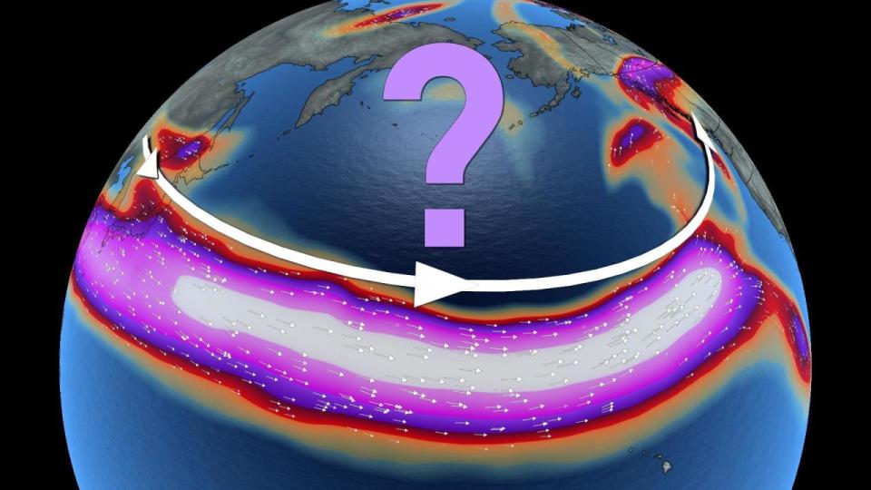
When looking at it from afar, it’s a thing of meteorological beauty. A ruler-straight jet stream, stretching more than 10,000 kilometres across the Pacific ocean, from China to B.C., is in development.
DON’T MISS: Winter takes a breather in major Canadian cities with January thaw
It will batter the West Coast first with significant impacts and have a downstream-weather effect on the East to finish January, with a chance to linger into February.
Here’s what weather you can expect during its journey across the country.
Atmospheric rivers target the West Coast
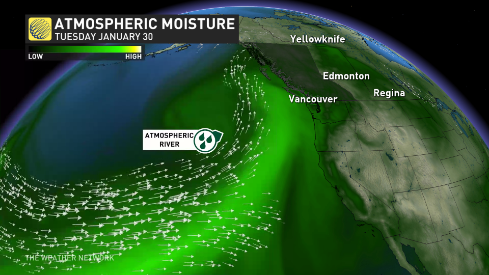
Atmospheric river events will line up for B.C at the beginning of next week. A significant warm-up will lead to alpine rain as freezing levels spike over 2000 metres, in addition to heavy precipitation rates.
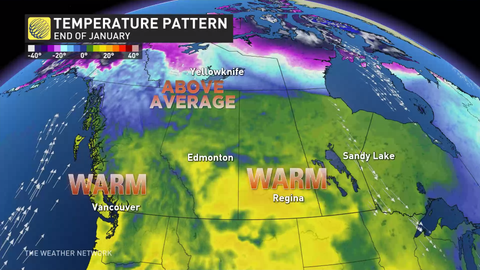
The Pacific air will stream northward, creating an intense warm-air ridge. Temperatures that are 10-20+ degrees above seasonal are expected to blanket a huge amount of Canadian real estate.
Nearly all of the Northwest Territories and all three Prairie provinces will be significantly above normal, temperature-wise, come Tuesday.
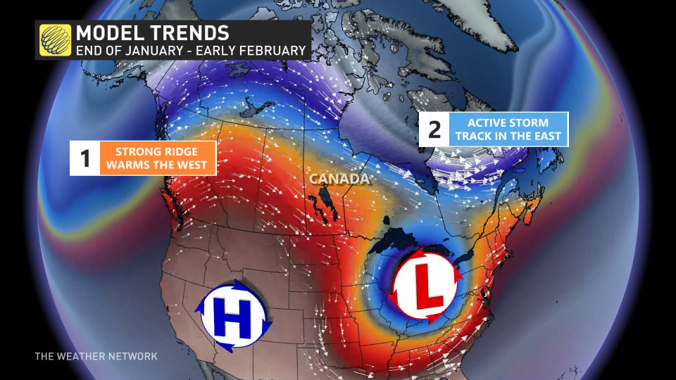
 Opposite effect for the East
The position and orientation of the jet stream will result in a contradictory effect for parts of Eastern Canada. A trough over the regions is emerging and will bring more seasonal air, or colder, and an active pattern.
The reinforced cold will interrupt the January thaw being experienced in Ontario and Quebec, but just how cold it will get and how long it will stay in place is uncertain. However, at some point next week, a warming trend should occur for southern Ontario, but southern Quebec should remain below freezing until late week.
For Atlantic Canada, a shot of air from the Arctic is expected early next week with colder-than-normal temperatures, then turning much milder for the second half of next week. The region isn’t expected to see any significant storms during that time.
With files from Rachel Modestino and Dr. Doug Gillham, meteorologists at The Weather Network, and Nathan Howes, a digital reporter at The Weather Network.
*****
Credit belongs to : ca.news.yahoo.com