 This winter season has been quite the contrast.
We went from a record-warm December to record cold in January. Next week, Canada bids farewell to the polar vortex, as another well-known guest makes a countrywide return.
DON’T MISS: Canada is colder than a cloud, and looks like one on satellite
Currently, millions of Canadians shiver in record-cold, below-seasonal temperatures that 2024 has brought, but that is all about to change. Remember last month’s wild, warmth ride? We were extremely mild with record-breaking temperatures, trending well above seasonal.
Ski resorts struggled to open or stay open as a result of the mild pattern and lack of substantial snowfall. Well that pattern will be making a brief sequel across Canada this week.
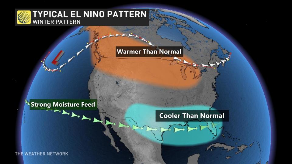
The temperatures will relax as we close out the week with much warmer temperatures across the country. The reason for this pattern change? El Niño. A more typical feel to an El Niño winter is returning, giving us well above seasonal temperatures again for most of Canada.
British Columbia could see the freezing levels take a soar about 1500 metres, bringing rain and a rain-snow mix to the South Coast mountains. By the weekend,, Vancouver will be back up above its seasonal six degrees.
Soon the mild air will spread into Calgary, Alta., by early next week, with temperatures likely reaching the freezing mark Tuesday for the first time in 13 consecutive days. Winnipeg and Eastern Canada will benefit, too, through the work week. The climb out of extreme cold, as well as problematic ski conditions, are in sight.
 Beyond that, the next few weeks will feature some available Arctic air, but not nearly as potent as what we have seen as of late. Mild conditions will likely hold on in the West, with colder air and an active pattern sinking into the East to close out January and launch into February.
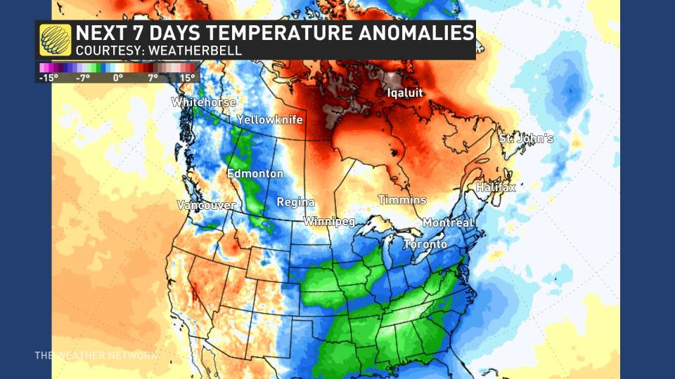
Temperatures as reflected by models in the graphic above will be closer to seasonal over the next week, and many will be above-seasonal, as indicated in the orange hue.
Keep in mind that you can be above seasonal and still experience cold temperatures as we are in the heart of the winter season, and normals are still relatively cold.
 That also means we can still get snow in this pattern.
As we look ahead to a more active jet stream into early February, the cold will likely be paying a visit to the East, while the West is expected to remain warm.
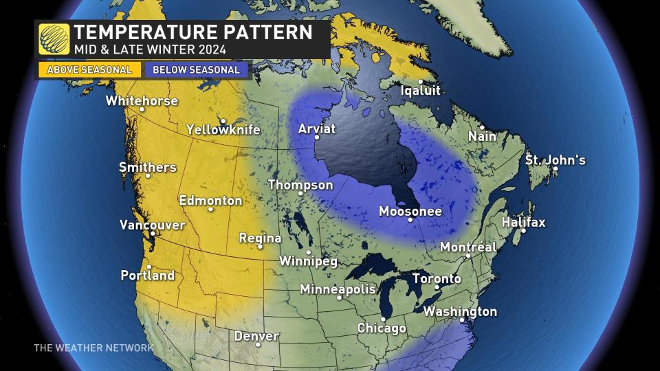
That is not far off from what Dr. Doug Gillham, a meteorologist at The Weather Network, was calling for months ago in our Winter Forecast seen below.