
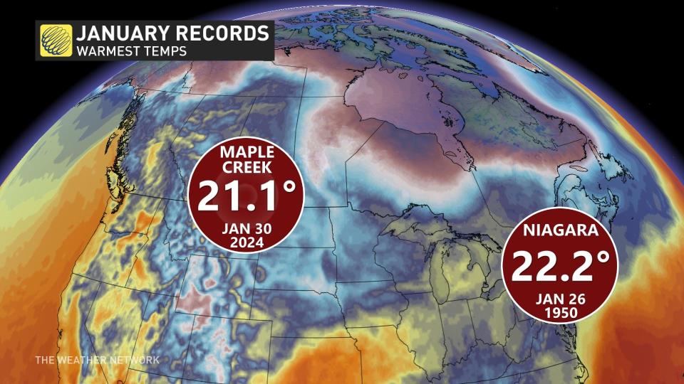
For Canada to experience a temperature above 21°C in January, a lot of factors have to align to experience such a historic temperature event.
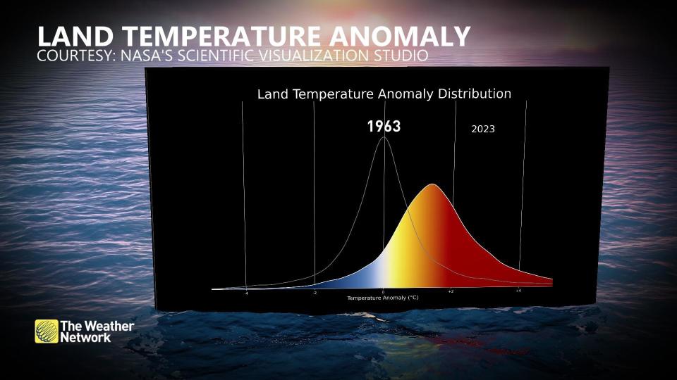
Earth is heating up. We’ve shifted the planet’s temperature anomaly distribution over the past half-century, increasing the likelihood of more extreme temperatures.
SEE ALSO: Animals rescued after flooding hits B.C. shelter, support welcome
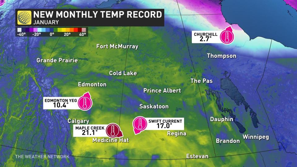
 However, this is not the primary reason we saw such mind-numbing warmth in Saskatchewan, as the localized factors exerted far more influence on the Jan. 30 temperature reading in Maple Creek, Sask.
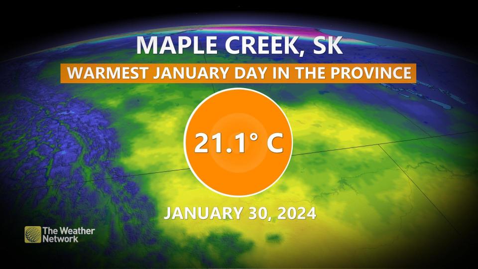
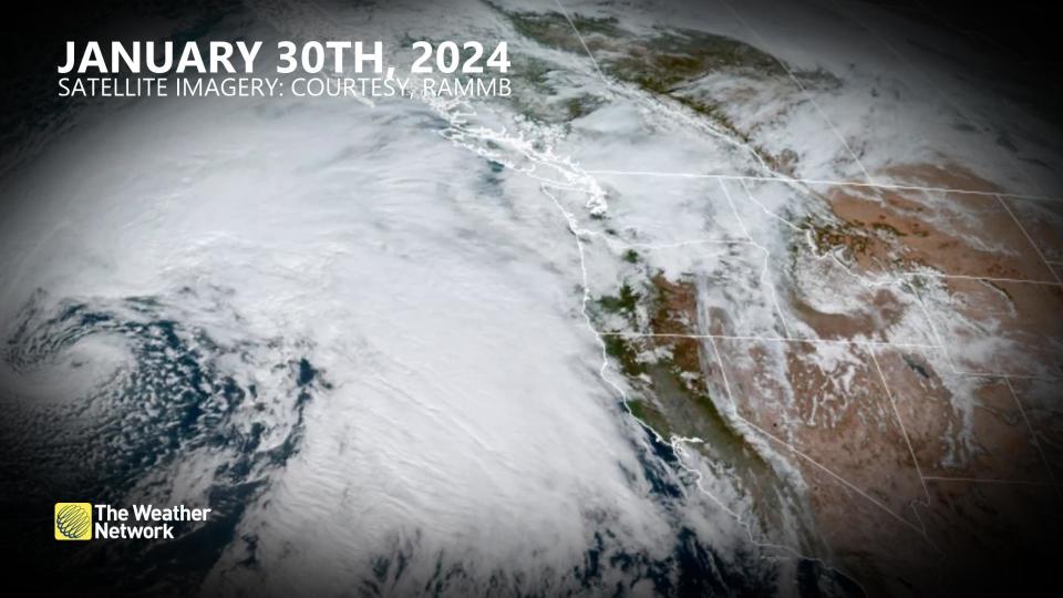
That hasn’t stopped El Niño from unleashing a strong, subtropical jet stream that’s associated with these potent atmospheric river events along the west coast of North America.
The tropical influence and weather patterns
The warm air mass off the Pacific Ocean that was associated with a moist flow from the Hawaiian Islands was on the upper edge of climatology, with temperatures aloft more than 10 degrees above normal. This pineapple express phenomenon is known to bring some of the mildest winter weather to British Columbia. The pattern releases tremendous amounts of energy as it ascends and crosses the Rockies.
As the air descends the Rockies, it is compressed and warmed at about a degree per hundred metres of descent.
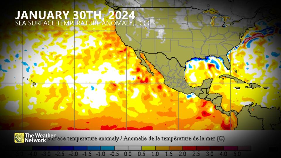
Sea surface temperatures
All eyes are on the North Pacific, as that’s the source region of this record-breaking air mass. Sure enough, some warm sea surface temperature anomalies can keep the air mass slightly warmer, which also increases the amount of moisture transported in the atmosphere.
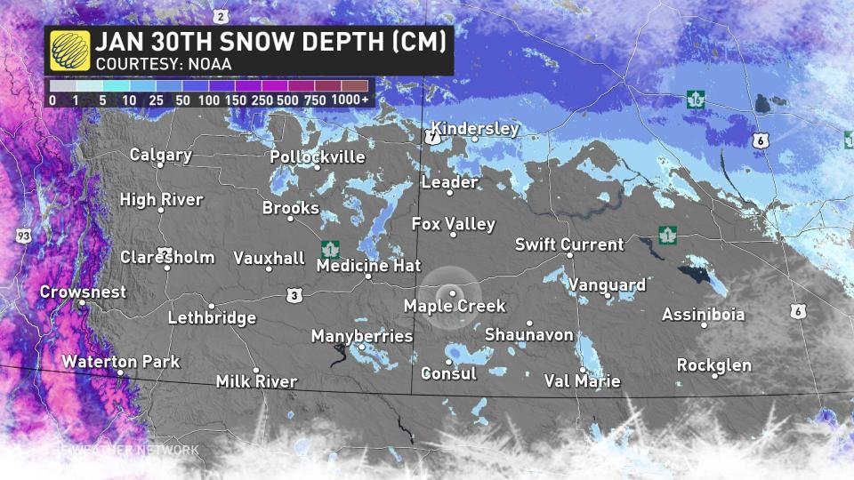
Snowless ground
The drought across the Prairies is no secret, and with the exceptional heat, there is minimal snowpack nestled across southern Alberta and Saskatchewan.
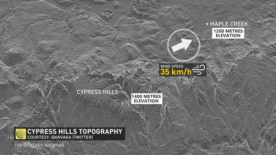
Localized wind: The downsloping effect
What’s downwind of Maple Creek? The Cypress Hills, of course.
*****
Credit belongs to : ca.news.yahoo.com


