
The first weekend in February will be a snowy one for parts of the Prairies, a rather stark change after the record warmth earlier this week for many.
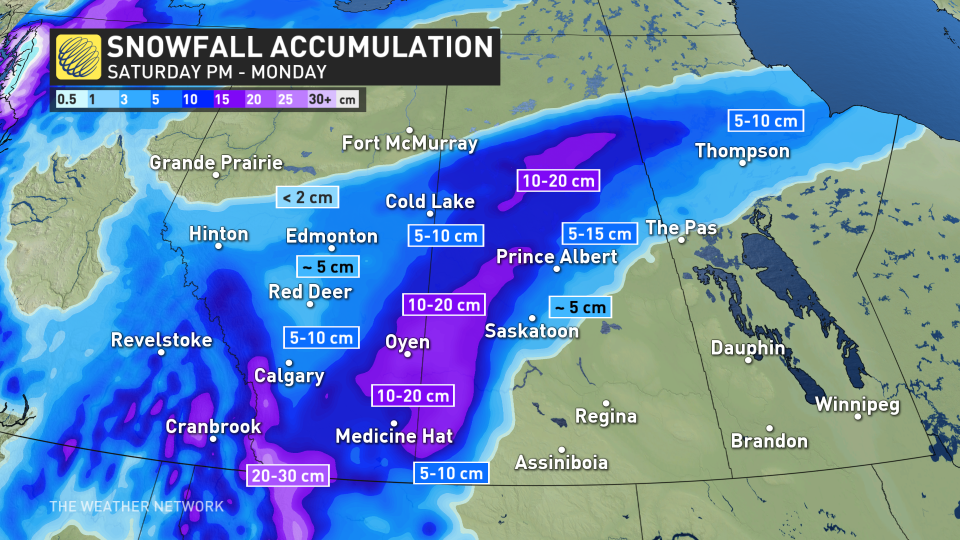
Winter storm and snowfall warnings are in place for southern Alberta, the hardest-hit region during this event. But, that doesn’t mean Saskatchewan is out of the woods, with 10-20 cm expected for parts of the province, as well. Saturday will feature the heaviest snowfall rates, so consider postponing non-essential travel until conditions improve.
DON’T MISS: El Niño and the polar vortex take centre stage for winter’s final chapter
 Few places on Earth lurch between weather extremes quite like the Prairies. It’s only been a few days since a town in southern Saskatchewan saw a whopping daytime high of 21.1°C, marking the province’s warmest January temperature ever recorded.
Saturday
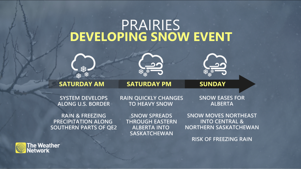
The days of all-time warmth are in the rearview mirror now as a disturbance moving over the border will usher in a spell of wintry weather across the western half of the Prairies.
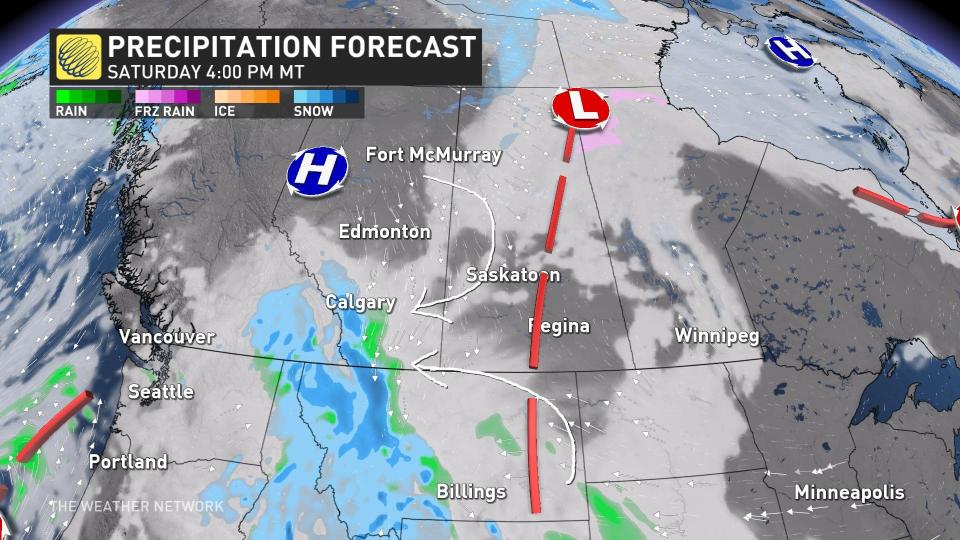 Precipitation will begin moving across the international border into southern Alberta during the day Saturday, starting as snow at higher elevations and possibly rain in the foothills. Temperatures will fall as the sun goes down and force that rain to change over to snow as precipitation spreads from west to east.
Expect heavy snowfall along all major routes south of Calgary by Saturday evening, with flurries likely in Calgary proper.
MUST SEE: How Omega blocks and Rex blocks can affect Canada’s weather
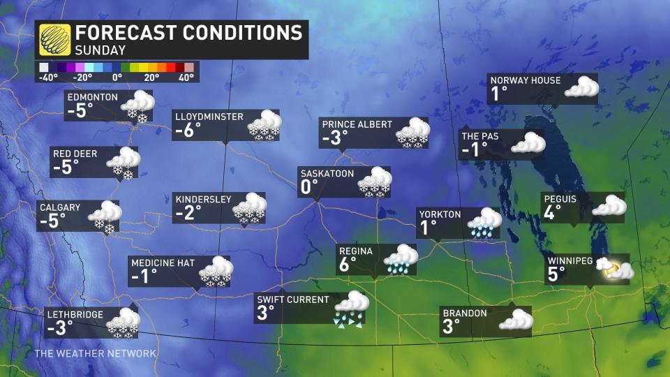
Sunday
We’ll see the snowfall lift north into Red Deer, Oyen, and southwestern Saskatchewan by Sunday morning. Expect the snowfall to continue here through the day, moving north into Edmonton and Cold Lake by the evening hours.
We’ll see general totals of 5-10 cm closer to Calgary and Edmonton in the west and Saskatoon and Prince Albert to the east.
In the warm sector of the developing low, it’s a mild rain or a wintry mix for Swift Current and Regina, Sask., through the day on Sunday.
Stay with The Weather Network for all the latest on conditions across the Prairies.
WATCH: What did Canada’s prognosticating animals predict on Groundhog Day?
*****
Credit belongs to : ca.news.yahoo.com


