This Day In Weather History is a daily podcast by Chris Mei from The Weather Network, featuring stories about people, communities and events and how weather impacted them.
On Thursday, July 22, 1993, the levee at Kaskaskia Island gave way and flooded the Illinois village. Kaskaskia Island was one of the victims of the Great Flood of 1993.
The Great Flood of 1993 is one of the most devastating floods in the United States history, causing around $15 billion in damages.
The Mississippi and Missouri rivers and their tributaries flooded from April to October 1993. The Missouri River is the longest in North America, and the Mississippi River is the second.
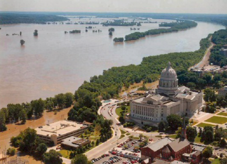
U.S. Army Corp of Engineers photo of the Missouri River’s damage to U.S. Highway 63, Jefferson City, Mo., near the Missouri Capitol building during the “Great Flood of 1993”. Courtesy of Wikipedia
The flooded area was around 78,000 km2, the worst in the U.S. since the Great Mississippi Flood of 1927.
The issues started in the summer of 1992. The area experienced heavy rain, lower temperatures, and above-normal soil moisture. The Missouri and upper reaches of the Mississippi River basins were also experiencing above-average reservoir levels. These conditions lasted throughout the fall, and in the winter, the area received heavy snowfall.
The area was also impacted by storms. By June 1, 1993, the soils were saturated.
River levels reached almost six metres above the flood stage. Almost all the 700 privately built agricultural levees along the Missouri River were flooded.
Record levels of rain persisted into July. River gauges along the Mississippi and Missouri rivers faulted. Though sandbagging efforts were widespread, the floods were too aggressive in many areas.
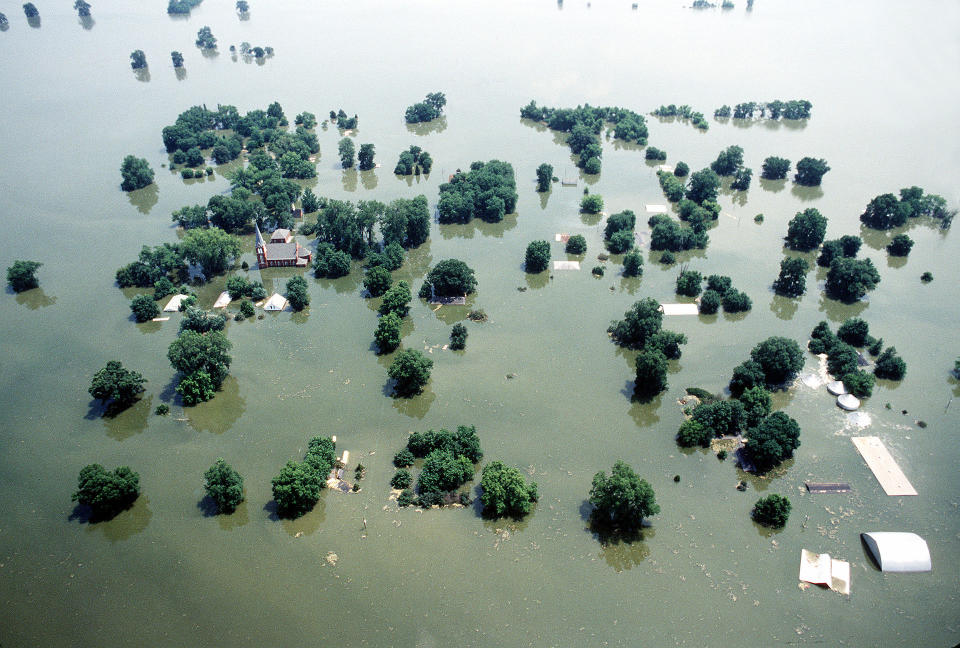
“1993 flooding of Kaskaskia, looking south downriver; church spire is in center left.” Courtesy of Wikipedia
On Kaskaskia Island, many people fled as they heard a sand boil erupt inside the levee. Some stayed in their village to try to sandbag the flooding areas. The levee was 50-feet high and was protecting the 15,000-acre Island and its residents.
On July 22, by 2 p.m., water covered the entire town. This wasn’t the first time the island flooded. Most of the area was destroyed in April 1881 from another flooding event from the Mississippi River.
To learn more about the Kaskaskia flood, listen to today’s episode of “This Day In Weather History.”
Subscribe to ‘This Day in Weather History’: Apple Podcasts | Amazon Alexa | Google Assistant | Spotify | Google Podcasts | iHeartRadio | Overcast‘
*****
Credit belongs to : ca.news.yahoo.com