After two significant flash-flooding events in as many weeks, we have to be on guard for another wave of heavier rain to push in late Tuesday into Wednesday morning.
With lots of locations around Halifax, N.S., still fully saturated, soils will likely be too compromised to fully absorb heavy runoff, so more pooling and ponding is expected.
DON’T MISS: Significant flooding hits Halifax area for second time in weeks
Those that reside in central New Brunswick should also be vigilant for flooding as several computer models highlight the risk of heavy rainfall spilling in from Quebec.
Tuesday overnight and Wednesday
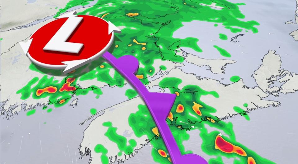
Areas: The Maritimes
Timing: Overnight Tuesday, through Wednesday morning
Weather: A combination of several weather factors are stacking up against the already-soaked Maritime provinces. An incoming system, with ample subtropical moisture, means more heavy rainfall and thunderstorms Tuesday overnight into Wednesday Morning. With a blocking high out to sea, the system is expected to move slowly, increasing rainfall total potential once again.
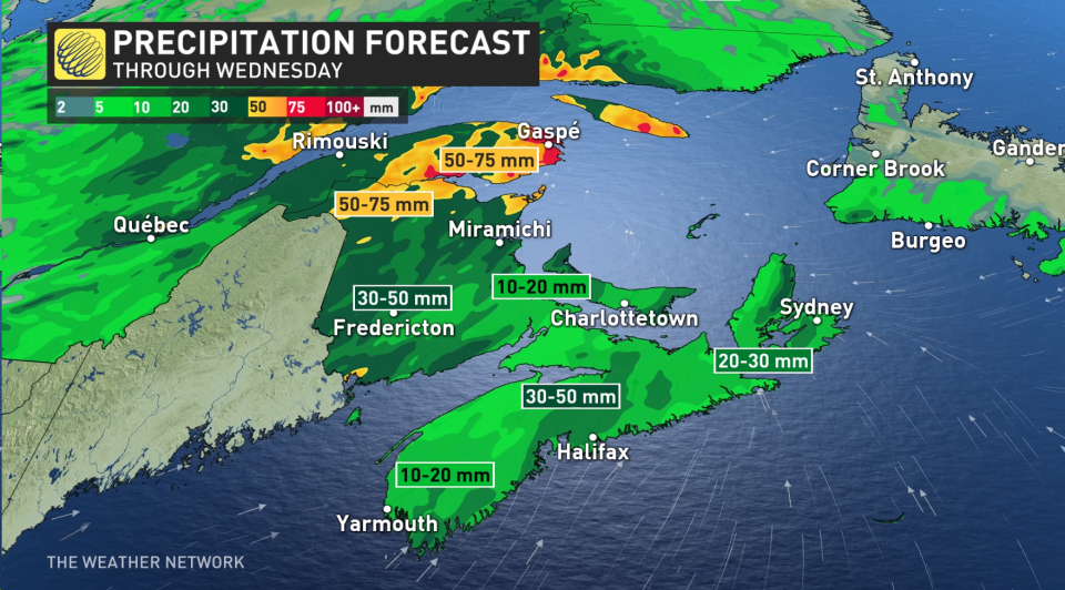
Rainfall totals could reach up to 50 mm in Nova Scotia, and well in excess of that in New Brunswick. Rainfall warnings and special weather statements have been issued by Environment and Climate Change Canada (ECCC), and will likely persist into a soggy Wednesday morning.
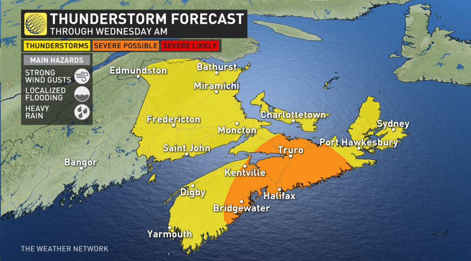
As for timing out the precipitation, it’s forecast to be convective in nature. That means there’s another risk of enhanced precipitation from thunderstorms falling through pre-dawn Wednesday. By Wednesday morning, the thunderstorm activity will be likely situated across the eastern Maritimes.
Those that reside in central New Brunswick should be vigilant for flooding, as well, as several computer models also highlight the risk of heavy rainfall spilling in from Quebec.
RAINFALL OUTLOOK
The wetter-than-normal pattern is expected to stick around for the bulk of August. That will ring true this week with a one-two punch that will quickly follow Wednesday’s storm. Closing out the work week, another low bowling balls across Eastern Canada will once again will tap into subtropical moisture. By Friday, it pulls a concerning, high-moisture environment north, right back to the Maritimes' doorstep. Worries are mounting that heavy rain may once again cause localized flooding by the weekend, especially in Nova Scotia.
RELATED: Section of East Hants highway washed out less than 24 hours after reopening
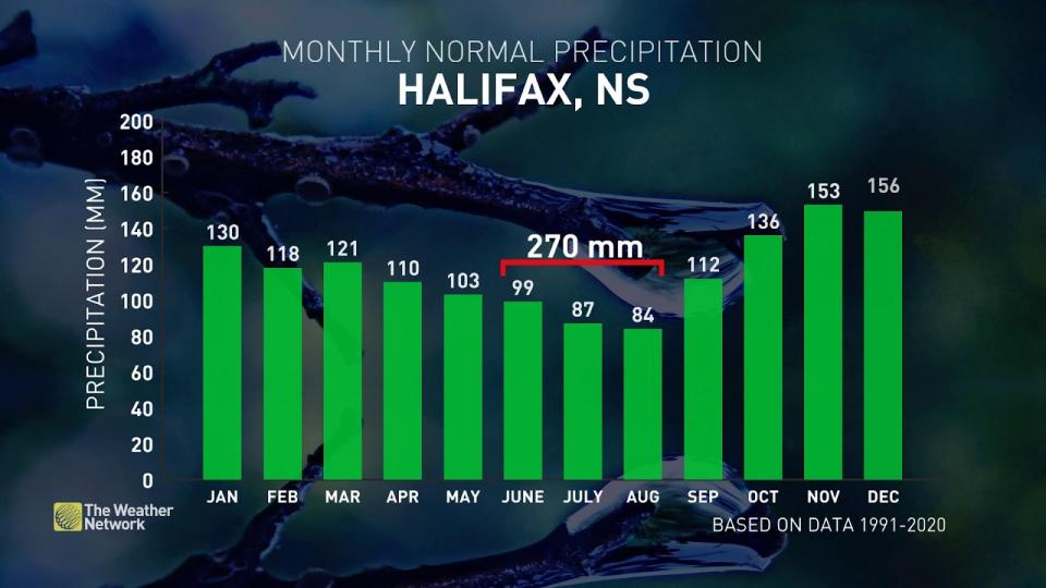
Halifax typically sees under 300 mm of rainfall for the months of June, July and August. However, this summer, a large portion of the Halifax area has been swamped with more than 500 mm of rainfall, or roughly 200 per cent of normal. The incoming water truly has little places left to go.
With reservoirs already at or above normal, and a super-saturated ground, residences should prepare for further roadway pooling and localized flooding potential this week.
Stay with The Weather Network for the latest on conditions across the Maritimes.
WATCH: Manholes explode with floodwater in Halifax in another round of torrential rain
*****
Credit belongs to : ca.news.yahoo.com


