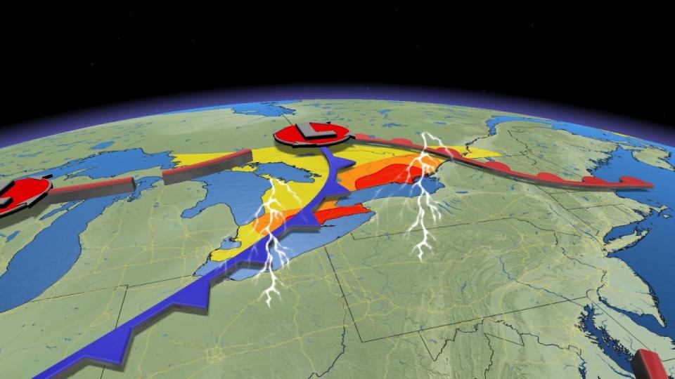
Southern Ontario is on the lookout for several rounds for severe weather on Friday and Saturday.
Southwestern portions of the province will face the risk on Friday, while a more serious and widespread risk builds throughout southern Ontario during the day Saturday.
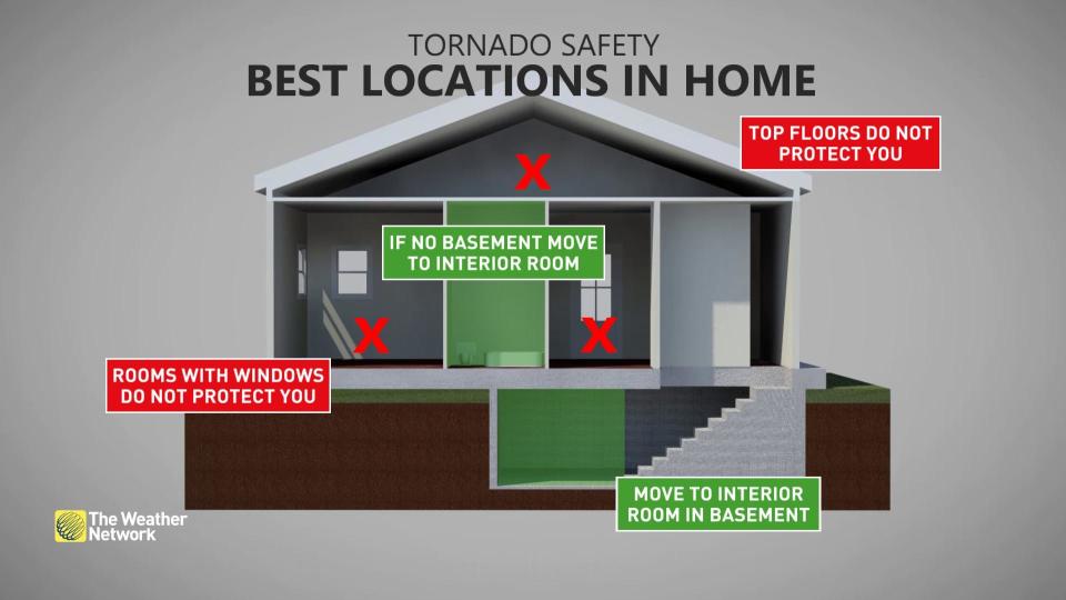
STAY SAFE: Don't fall victim to these seven dangerous tornado myths
Isolated tornadoes are possible both days. Pay close attention to severe weather alerts in your area through this weekend, and have a safety plan in place if threatening weather approaches whether you’re at home or on the road.
Friday evening into the overnight
Location: Southwestern Ontario
Timing: Friday evening and overnight
Weather: Southwestern Ontario will need to watch for approaching thunderstorms as we head into the latter half of the day on Friday.
An approaching warm front will trigger thunderstorms across the region Friday evening. These storms will pack the potential for heavy rain, large hail, and even the risk of an isolated tornado, particularly around Sarnia.
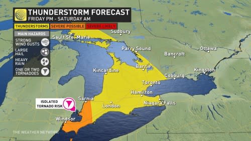
The nocturnal storms will likely make their way eastward across the southwest throughout the overnight hours. Those around the western edge of Lake Ontario should start to see thunderstorms by pre-dawn on Saturday.
RELATED: PHOTOS: Downpours lead to flooding in the National Capital Region
Saturday
Location: Southern Ontario
Timing: Saturday morning through the afternoon
Weather: Many in the GTA will likely be waking up to thunderstorms on Saturday morning. The storm system will track its way east throughout the day, heading towards cottage country and eventually towards the eastern part of the province in the afternoon.
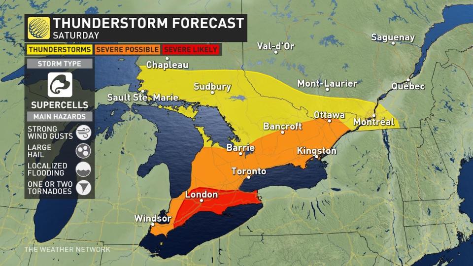
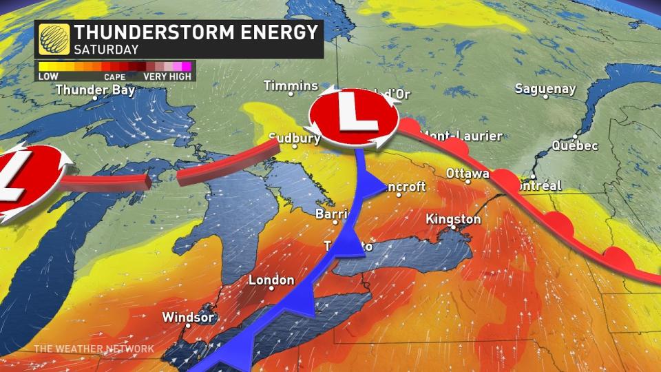
This system will have plenty of moisture and instability to work with, allowing for widespread thunderstorms to develop throughout the region. These storms could produce heavy rain, large hail, and the risk for one or two tornadoes. Heavy rainfall could lead to a threat for localized flooding, especially in eastern Ontario where we saw torrential rains on Thursday.
Those around the London and Niagara regions as well as east of the GTA should be on the lookout for severe storm activity throughout the afternoon and the evening.
Prepare
Ensure you have a way to receive severe weather alerts the moment they’re issued. Have a safety plan in place in case threatening weather approaches your location, especially if you plan to spend time outdoors over the next few days.
Motorists should stay alert for standing water on roads. Never try to drive through standing water. It’s impossible to tell how deep the water is until it’s too late, and the road may have been washed out beneath the water.
Stay tuned to The Weather Network for updates on your forecast in southern Ontario.
WATCH: Live in an apartment? Here's how to stay safe in a tornado warning
*****
Credit belongs to : ca.news.yahoo.com