 While many areas across the country saw their first snow of the season heading into the long Thanksgiving weekend, we’re tracking Canada’s first blizzard warning of the year across one critical highway.
The days-long spell of blowing snow and frigid temperatures are bad enough for travellers, but it adds insult to injury that the blizzard warning is too far away from comfortable temperatures in the mid-teens.
DON’T MISS: Giant Antarctic ozone hole grows 2.5 times bigger than Canada
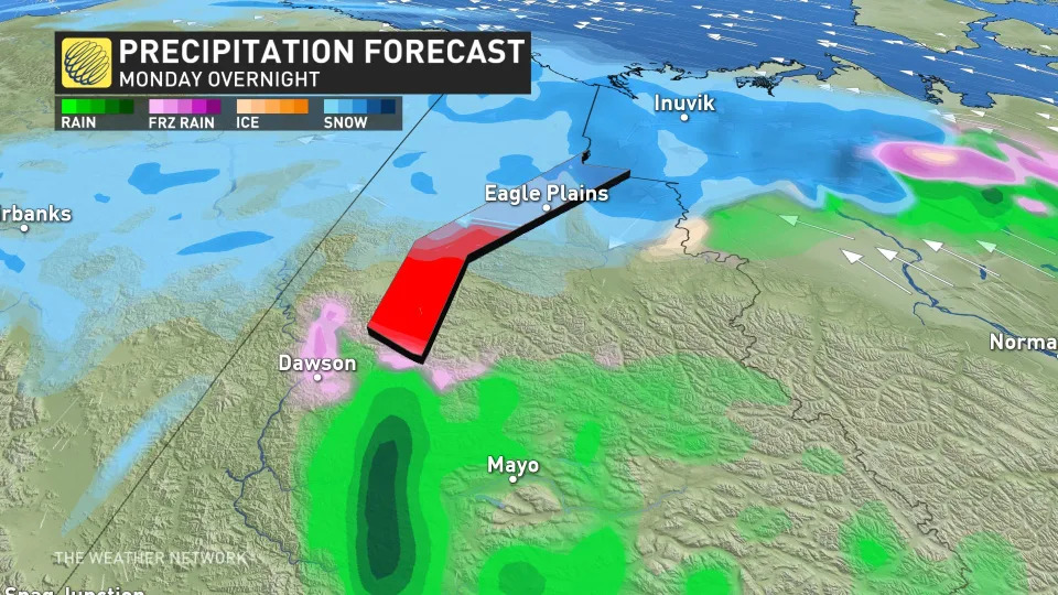
Environment and Climate Change Canada (ECCC) issued a blizzard warning for the Dempster Highway this weekend, warning travellers on this major northern thoroughfare of dangerous travel conditions at times through early Tuesday morning.

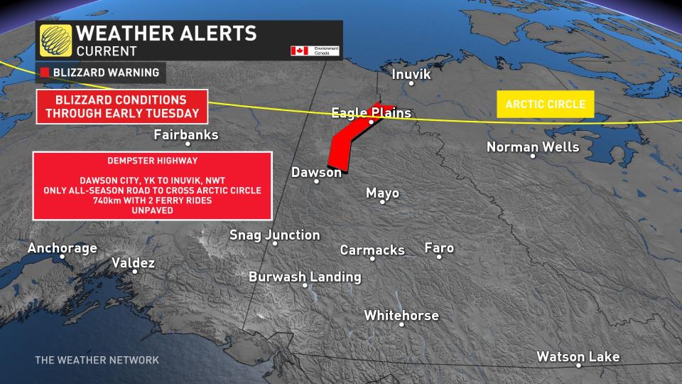
“Travel is expected to be extremely hazardous due to reduced visibility,” ECCC said in its warning. “Visibility will be suddenly reduced to near zero at times in heavy snow and blowing snow.”
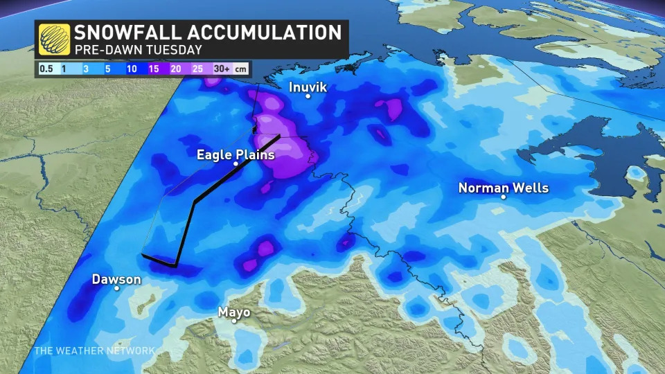
Some areas could see more than 15 cm of snow by Tuesday, with blowing and drifting likely in many locations.
 The Dempster Highway is a lifeline for folks who live in northern portions of Yukon and the Northwest Territories. Running for more than 700 km between Dawson City and Inuvik, the road is open year-round to shuttle people, goods, and services to and from communities up north.
Dempster Highway’s exposure to unforgiving Arctic conditions makes travel here a difficult journey during the long cold season.
The return of cold air and snowy conditions is a welcome sight for many residents affected by this year’s prolific wildfires, which have consumed more than 1.4 million hectares of land in the N.W.T. alone and sparked mass evacuations at times.
RELATED: The Mackenzie River is a lot lower than normal, worrying those who rely on it
 This weekend’s burst of wintry weather up north is connected to the wavy jet stream that’s thrown the whole spectrum of active weather at Canada for this Thanksgiving weekend.
A lobe of the polar vortex swooped down over Eastern Canada to fuel historic snows in parts of Ontario and a deluge of tropical rains across Quebec. Farther west, a ridge of high pressure brought calm and warm conditions to much of the Prairies and British Columbia.
Upstream, though, another potent trough dipping over the Gulf of Alaska sparked a series of low-pressure systems tracking into southern Alaska. These systems are funneling moisture up and into the territories, where cold air has allowed for periods of snow to develop.
The tight gradient between low pressure to the south and high pressure to the north cranked up the winds, making for an extended period of blowing snow across northern portions of Yukon and the Northwest Territories, including along the Dempster Highway.
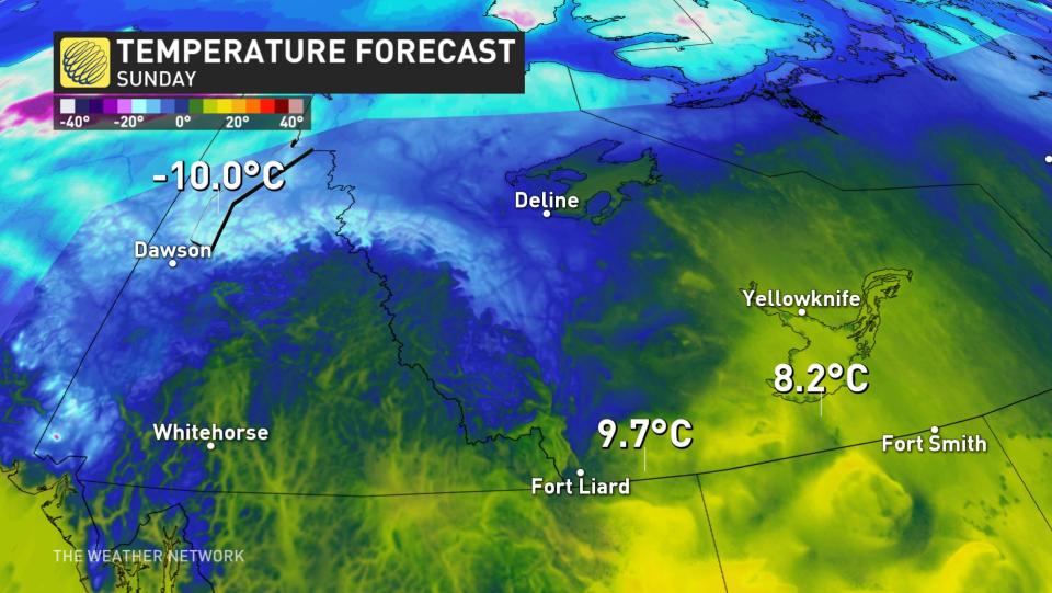
In fact, the Northwest Territories is in contention for the most dramatic contrast in weather conditions across the entire country, thanks in large part to that formidable ridge over the Prairies.
We saw a 35-degree temperature spread between the northern and southern portions of the territory during the day Sunday. A relatively balmy high of 20.0°C in Hay River contrasted with a frigid low of -14.5°C nearly 1,000 km north near the coast in the Tuktut Nogait National Park.
WATCH: A sign of the times, B.C. wildfires might burn into winter
*****
Credit belongs to : ca.news.yahoo.com