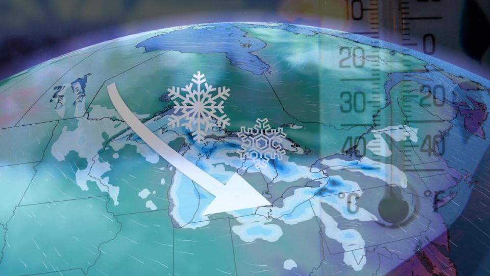
 A cold wind’s blowing, and it’ll reach the Great Lakes next week in true November fashion.
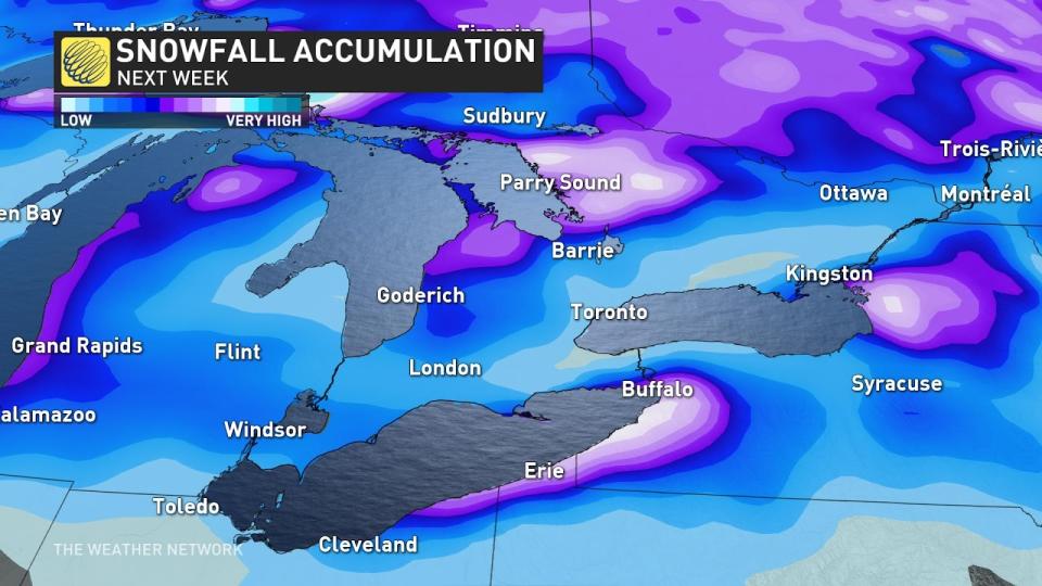
We’re looking ahead to the potential next week for multiple rounds of lake-effect snow to target Ontario’s traditional snowbelt communities into next weekend.
While specific snowfall accumulations are still a bit fuzzy this far out, the setup looks favourable for shovellable snows and possibly whiteout conditions in spots next week. Factor this potential into any travel plans you may have between Sunday and next weekend.
DON’T MISS: Why the Great Lakes produce some of the world’s heaviest snow
Weekend clipper kicks off the snow potential
After a week of above-seasonal temperatures across southern Ontario, a front sweeping the province on Friday sent temperatures plunging back down to normal territory for the middle of November.
Another dose of chilly air is on the way later this weekend as a clipper moves through the northern half of the province.
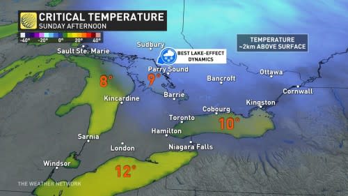
Arctic air flowing in behind the clipper will set up our first opportunity for bands of lake-effect snow across Georgian Bay, with water temperatures in the upper-single digits and air temperatures about 2 km above the surface falling well below freezing.
These sporadic snow squalls could reach the Greater Toronto Area (GTA) through the day.
Colorado low sets up the next lake-effect opportunities
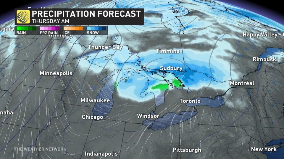
Forecasters are monitoring the development of a Colorado low expected to approach southern Ontario next Tuesday. While the system’s precipitation should remain mostly rain for southern Ontario, it’s the cold air filtering in behind that may cause issues throughout the week.
 GET THE LATEST: Eyes on a Colorado low in southern Ontario next week as Arctic air settles in
A second dose of Arctic air sliding in behind that low-pressure system looks to bring our coldest temperatures of the season. The sharp temperature gradient between the warmer lakes and the frigid airmass pouring in will set the stage for multiple rounds of lake-effect snow squalls throughout the region.
As usual, the westerly winds may make this a serious snowfall event for eastern shores of the lakes. While the snow squalls off Erie and Ontario should remain over New York, we’ll have to closely monitor the progress of squalls that develop off Lake Huron and Georgian Bay. These lake-effect snow squalls could produce whiteout conditions at times.
Check back frequently this weekend and into next week as these lake-effect snow opportunities draw closer are forecasters have a clearer picture of potential accumulations and travel impacts.
WATCH: How the lakes churn out mammoth bands of snow
*****
Credit belongs to : ca.news.yahoo.com