
We’ll finally see warmer conditions arrive in Ontario this week—but not without some more wintry weather to slog through first.
Prepare for travel issues on both Monday and especially Tuesday as multiple systems bring a few opportunities for fresh snow to southern Ontario.
Good news for folks who don’t like the cold and also don’t mind the rain is that a warmer but unsettled pattern will build into the region for the second half of the week.
DON’T MISS: Great Lakes ice increased by 566 percent—but it’s on borrowed time
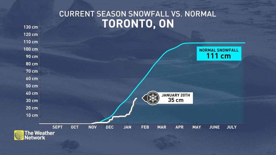
Toronto is still playing catch-up in the snow department given the overall mild conditions we’ve seen for much of the season. Vancouver saw more snow last week than Pearson Airport has recorded all season, with Toronto’s major airport picking up just 35 cm of snow so far this season.
Odds are looking good that we’ll add to that total a bit through Tuesday.
 A spell of very cold weather sweeping in from the northern Prairies will stretch just far enough south to keep southern Ontario chilly for the first half of the new workweek.
Forecasters expect flurries and light snow showers to develop across southern Ontario through the day Monday.
Minimal snowfall accumulations are expected from any of these showers, except along parts of the Huron shores where the lake could beef up accumulations to 5 cm in spots. While Monday’s totals will remain light, slippery roads are possible anywhere snow manages to accumulate.
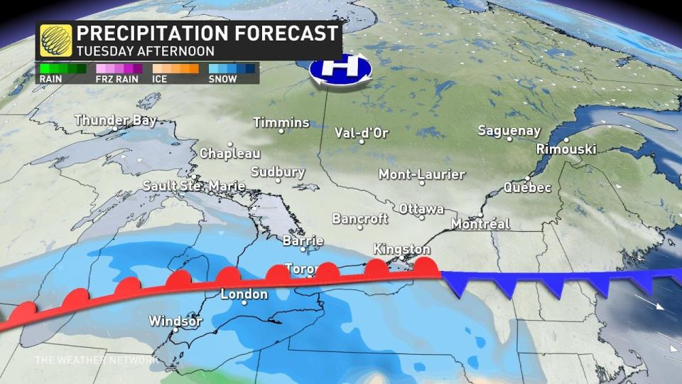
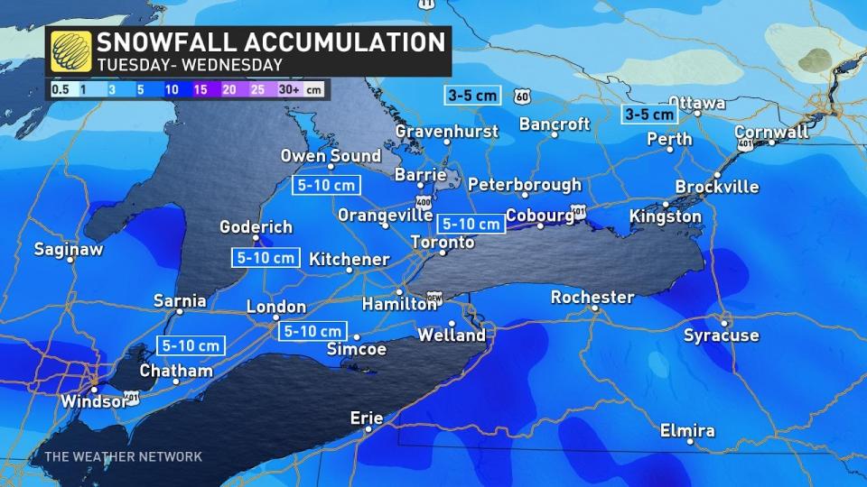 The bigger show arrives on Tuesday as a disturbance slides into the region from the south. A widespread opportunity for light-to-moderate snowfall will spread over southern Ontario through the day Tuesday. This will be a wet snow as temperatures will hover near the freezing mark into the evening commute.
Widespread totals of 5-10 cm are likely through Tuesday evening, with some areas possibly winding up on the higher end of that range. This round of wet snow may hamper the Tuesday evening commute, especially across the Greater Toronto Area.
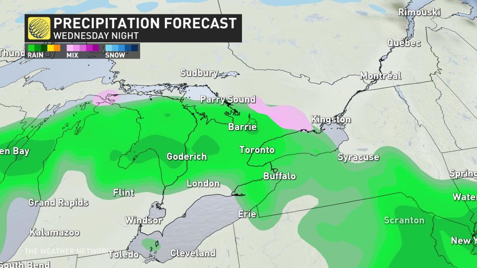
Warmer winds flowing in behind that disturbance will mark the start of an extended thaw across southern Ontario. Rainy weather will return to the region just in time for the warmer temperatures.
Ample moisture streaming in from the Gulf of Mexico will send rain north of the border through Thursday, with more unsettled weather predicted to linger into Friday.
It’s worth noting that this warmer setup is also ripe for the development of fog as warm air traverses the chilly Great Lakes. Plan ahead for potential visibility issues once milder air arrives.
Stay with The Weather Network for the latest on your forecast across Ontario.
WATCH: See the ‘ice art’ that appeared on a Lake Erie pier during recent cold snap
*****
Credit belongs to : ca.news.yahoo.com


