 This winter hasn’t felt very wintry on the Prairies. January’s bitter chill got washed out amid a sea of above-seasonal temperatures blanketing the heart of the country so far this season.
Never say never when it comes to the weather, and winter certainly isn’t done with us yet.
A pattern change in progress should bring a classic wintry feel to break the monotony of our seemingly never-ending November across the region.
DON’T MISS: Earth just experienced its hottest 12 months in recorded history
Temperatures have been pretty mild so far this season, with one of the warmest Decembers on record seeping into the swingy extremes of January.
The persistent warmth and relatively calm pattern has taken a toll on snowfall totals across the Prairies, with most of the region coming in solidly below seasonal through this point in the month. Edmonton has only seen 35 percent of its normal snowfall this winter.
We’ll head into Sunday with a sharp temperature divide across Alberta. Accumulating snow will begin to fall in Edmonton even as communities to the south push into the upper single digits and near the 10-degree mark.

The heaviest snow will fall to the north of the low, largely missing southern sections of the Prairies.
We’ll likely see 15-20 cm of snow on the ground around Edmonton by Monday morning. Similar totals will slice through central Saskatchewan, clipping both Prince Albert and Saskatoon to start the week.
Snow will spread across southern Manitoba through Monday, bringing a modest blanket of 5-10 cm to the Winnipeg area. Higher totals are likely north toward the lakes.
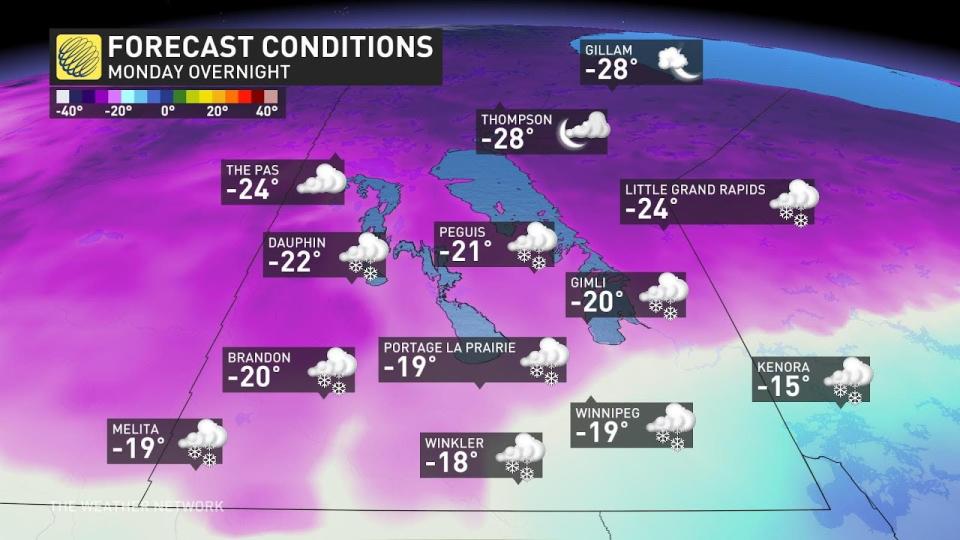
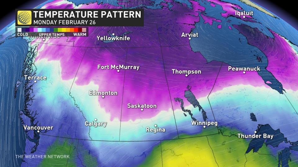
Northerly winds moving in behind the system will drag colder temperatures across the Prairies to start the week. This will deliver a wintry feel with the fresh snow on the ground. The coldest temperatures will linger through the first half of the week, with slightly below seasonal readings continuing toward next weekend.
Manitoba is in line for a dramatic temperature drop between Monday and Tuesday. Communities near the international border could see a nearly 30-degree temperature swing between Monday afternoon and Tuesday morning.
Header image courtesy of Getty.
Check back for all the latest on your forecast across the Prairies.
WATCH: Avalanche management keeps skiers safe
*****
Credit belongs to : ca.news.yahoo.com


