It was inevitable, southern Ontario. We knew we couldn’t hold off the snow for the rest of winter. Get ready for the return of slippery roads, slower commute times and reduced visibility on Thursday.
RELATED: Record warmth melts Great Lakes ice to historic February lows
The first fair amount of snow in a few weeks will return. Accumulations will vary, depending by location, but a range of 5-20 cm is expected for southern Ontario through Thursday. Needless to say, travel may be hazardous, especially in the hardest-hit regions. As well, high winds may cause tree branches to break and may result in local power outages.
While Thursday’s system will be short-lived, it won’t be the end of the snow, however. Behind the system, a multi-day, lake-effect snow event with strong, northwesterly winds will create blowing snow and dangerous whiteout conditions a times.
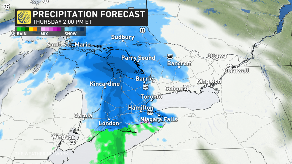
Snow spreads back into southern Ontario for Thursday
A low will track into Ontario Thursday with snow starting along the lakes Huron and Superior shorelines Thursday morning.
Snow will track east through the day with snowfall rates picking up for the afternoon and evening, reaching the Greater Toronto Area (GTA) late afternoon and the Ottawa region after the evening commute.
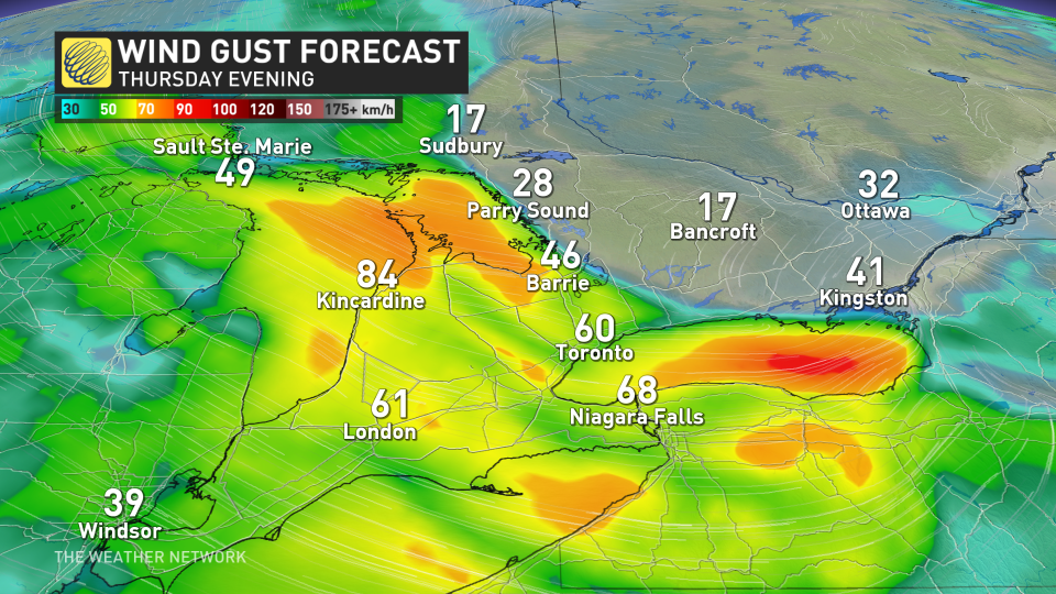
 Southern Ontario can expect a tricky Thursday evening commute. If you can leave work before 3 p.m. to 4 p.m., it may help missing the worst of the snowfall in Toronto.vModerate snowfall paired with 60-80 km/h winds will reduce visibilities along major highways.
Winds will begin in the southwest –– from Sarnia, London and along the Niagara Peninsula by Thursday afternoon –– making their way into the GTA by the evening.
Localized power outages may also occur where the strongest gusts occur.
Accumulations of 5-15 cm are expected for most areas, with 5-10 cm expected in the GTA.
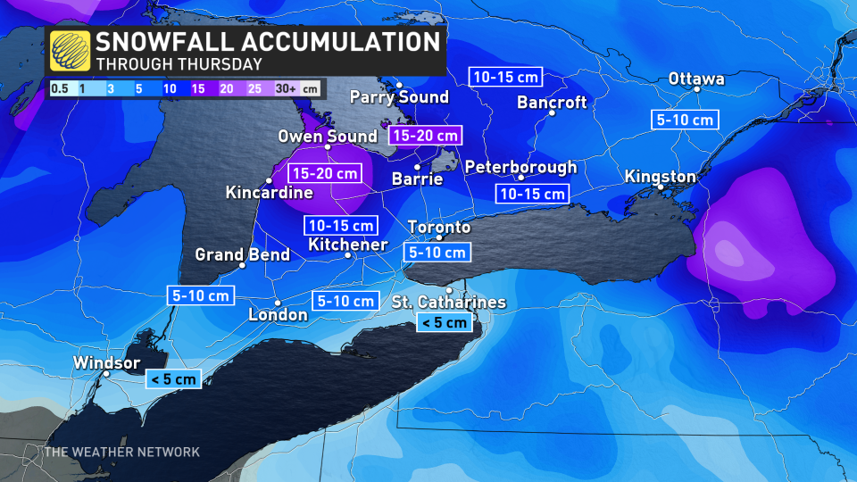
It’s a rather quick system, however, so snowfall will end for the GTA Thursday overnight and by Friday morning for Ottawa, leaving a fresh blanket of snow.
Lake-effect snow threat kicks off the long weekend
The snowfall totals do not include accumulations from the lake-effect bands for Friday into Saturday morning. Once the system snow has passed, lake-effect squalls will settle in behind, bringing continued snowfall to Lake Huron shores Friday.
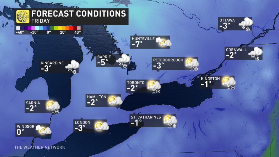
The wind will diminish Friday afternoon and evening, but breezy conditions will return at times again during the weekend.
Temperatures next week will be within a few degrees of seasonal. No major storms are expected through the middle of next week.
Thumbnail courtesy of Peter Lu/Submitted.
Keep checking back to The Weather Network for more forecast information and updates on your weather across Ontario.
WATCH: Record winter warmth sends Great Lakes ice to unprecedented lows
*****
Credit belongs to : ca.news.yahoo.com