It wouldn’t be the heart of summer in southern Ontario without muggy heat fuelling a risk for daytime thunderstorms. We saw a cluster of severe thunderstorms roll over southwestern Ontario on Friday afternoon, and much of the region will see another potential for severe weather on Saturday.
DON’T MISS: Clean-up underway after severe storms spawn tornado near Ottawa
A few of Saturday’s storms could pack the risk for strong winds and large hail. Heavy rainfall is an ever-present hazard when it’s this humid outside, so remain mindful of localized flooding and standing water on roadways.
Saturday
Areas: Portions of southern and northern Ontario
Timing: Through the afternoon and evening hours
Weather: An upper-level trough lingering over Ontario and the Great Lakes will provide the spark needed for thunderstorms to develop to kick off the weekend.
Scattered thunderstorms are possible across much of Ontario on Saturday, fuelled by daytime heating and ample humidity parked over the region.
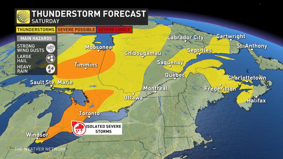
The strongest storms could approach severe limits, especially across southern Ontario, including much of the Greater Toronto Area and extending north into portions of cottage country. Additional severe storms are possible in northeastern sections of the province toward Timmins and Moosonee.
However, unlike Friday, forecasters have lower confidence in where these stronger storms could develop. Not all of the storms will reach severe limits, but those that do grow more intense could produce strong wind gusts, large hail, and heavy rainfall.
MUST SEE: Don’t fall victim to these seven dangerous tornado myths
Conditions on Saturday won’t be anywhere near as bad as what folks in eastern Ontario and southern Quebec saw on Thursday, but even the severe hazards and lightning of one thunderstorm is dangerous to any community in its path.
Pay close attention to warnings in your area and prepare to seek shelter immediately if hazardous weather threatens.
The storm activity should simmer down around sunset as we lose the heat of the day.
Prepare
Keep The Weather Network’s app handy on your phone to peek at the radar and keep up with watches and warnings as the day progresses.
Stay close to a safe shelter in case storms threaten your location. And remember, the greatest danger in any thunderstorm is lightning. If you can hear thunder, you’re close enough to be struck by lightning.
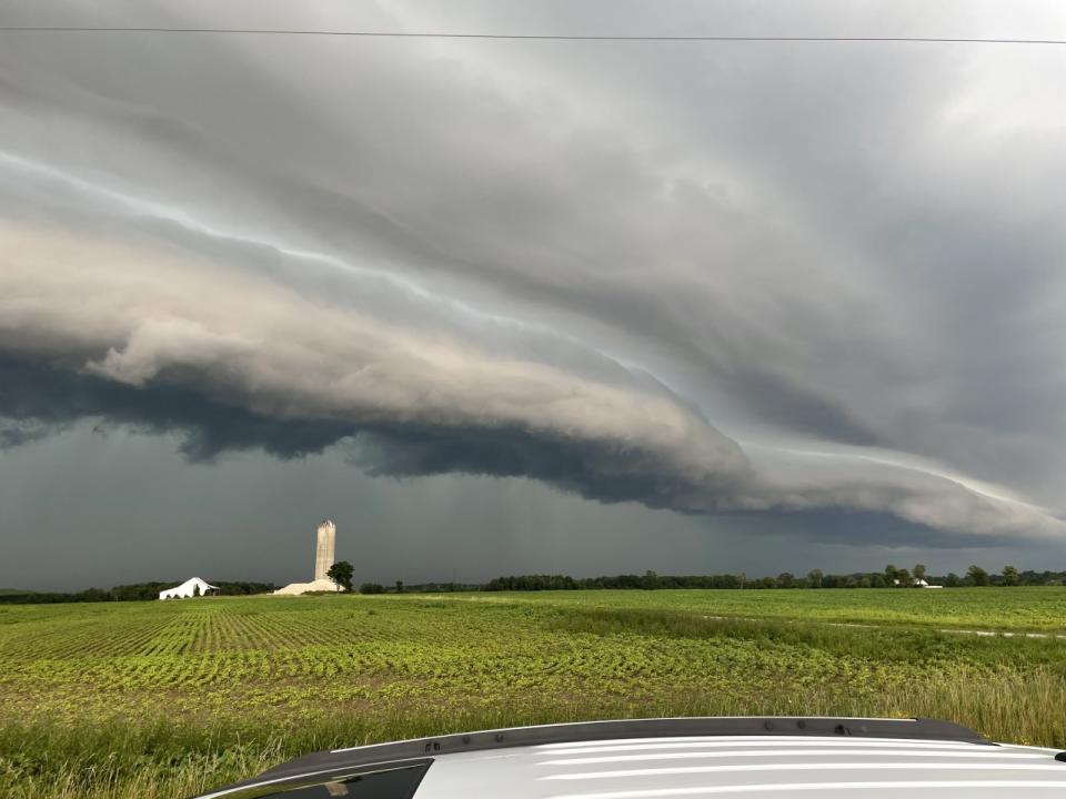
Thumbnail image courtesy of Brandon Ilczuk in St. Thomas, Ontario.
Stay tuned to The Weather Network for the latest updates on conditions across Ontario.
WATCH: Experts assess the Barrhaven tornado damage
*****
Credit belongs to : ca.news.yahoo.com