Flash flood warnings cover tens of millions of people in the southwestern United States—including Los Angeles—as Hilary leaves a historic mark on the region. Now post-tropical, Hilary will still bring life-threatening and locally catastrophic flooding through the day on Monday.
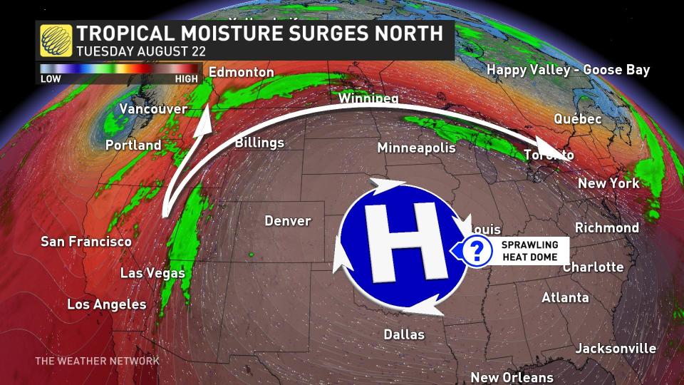
The storm’s prolific moisture will flow north into Canada through the week, fuelling rain chances from British Columbia right through to Quebec.
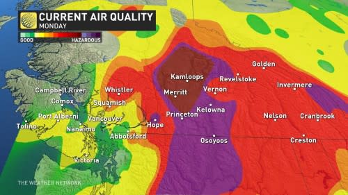
Unfortunately, the rain won’t be enough to fully stifle the fires raging throughout B.C., which have forced thousands to flee their homes and sent air quality plummeting to dangerous levels.
RELATED: Canada next in line for Hilary’s rains after historic U.S. impacts
Significant fires burning near Kelowna and Kamloops have contributed to atrocious air quality readings throughout the region, forcing residents to stay inside or wear quality masks to avoid harm from the air pollution.
Air quality is beginning to show some subtle signs of improvement with the approach of a trough from the south. The increasing cloud cover will make for less aggressive wildfire activity over the next couple of days, limiting the amount of smoke and fine-particulate produced.
The smoke limited daytime highs on Monday, with the hot spot being Pemberton at 26.4°C. Temperatures will continue to dip below seasonal by Tuesday before another warm-up lurks on the horizon to finish off August.
Looking ahead at Hilary’s remnants
We saw some clouds and rain push into Western Canada during the day Sunday as the far-reaching outflow from Hilary vents over the region.
A strong jet stream swooping over the western half of North America is giving the storm a boost, helping extend its reach from Mexico to Alberta and beyond.
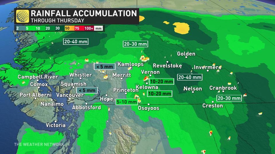
While some areas will see 20-40 mm of rain by mid-week, the bulk of the rain will miss communities where crews are struggling to get a leg up on out-of-control fires burning through B.C.’s Interior.
Stay tuned for the latest forecast update for Western Canada.
WATCH: The best time to prepare for a hurricane is well before one forms
*****
Credit belongs to : ca.news.yahoo.com