 If this was January, temperatures below -20°C would be barrelling towards Ontario and Quebec.
Instead, it’s early October, but it’ll still create a surprisingly strong temperature plunge this long weekend.
Visit our Complete Guide to Fall 2023 for an in-depth look at the Fall Forecast, tips to plan for it and much more!
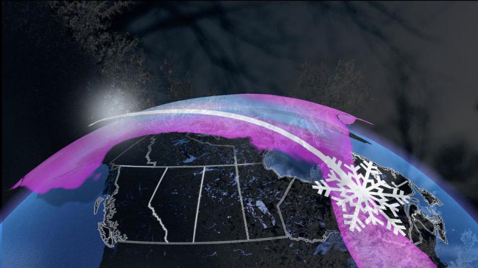
It’s worth considering if the polar vortex is the reason behind this shift in weather patterns. Over the last week, there have been indications that the polar vortex is expanding over the North Pole. This expansion, combined with an amplified weather pattern, will guide a sliver of the polar vortex south.
The residual warmth of the summer season is baked into the ground. The warm waters of the Great Lakes will also fight to moderate the air. A lack of snow cover works to warm the air as it travels great distances over Canada.
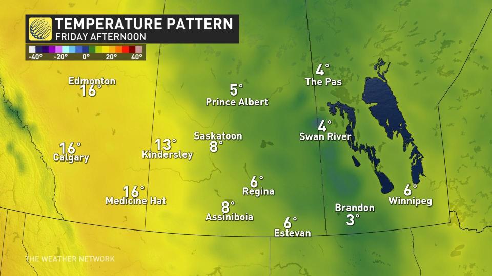
The Prairies get a taste of some seasonably cool temperatures, with highs stubbornly hanging in the single digits for Saskatchewan and Manitoba by Friday.
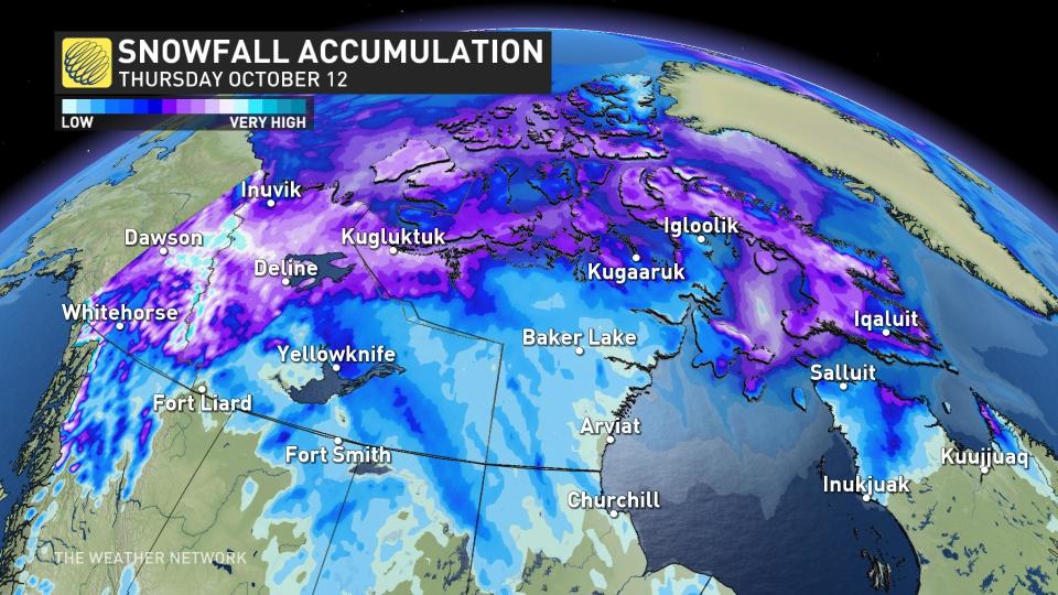
 By the time the air mass reaches Ontario, it’ll have warmed substantially, but on its path across Northern Canada, it’ll be the harbinger of some pretty hefty snow.
DON’T MISS: Unlikely upset: Ontario is overheating Las Vegas, Nev., this week
As B.C. basks in some beautiful weather, it’s this amplified pattern that drives the stratosphere polar vortex south, several kilometres above the surface.
This swirling, cool air will become cut off from the main atmospheric flow, overstaying its welcome next week, so it’ll be twirling over Ontario and Quebec right through Thanksgiving Monday. Temperatures at times are forecast to be as much as 8-10°C below seasonal.
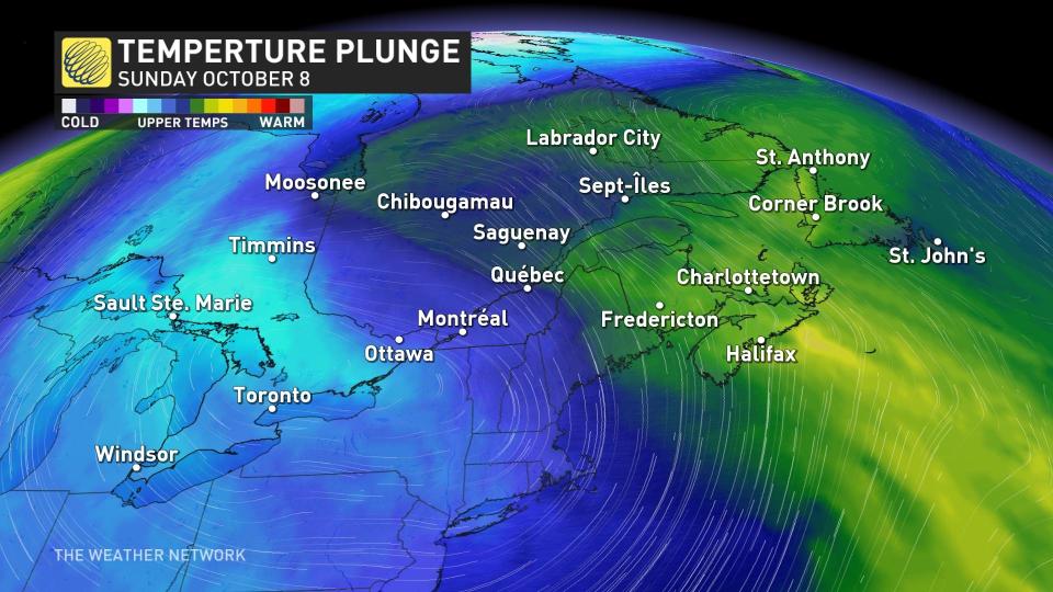 The air a few kilometres above the surface will be as cold as -13°C over southern Ontario by Sunday. Normally, at this time of year, this air remains above freezing there, but it’s also been way colder.
Weather balloons have been sampling the atmosphere for many decades, and on Oct. 3, 1974, they measured temperatures near -20°C aloft. This translated to temperatures at the surface below -5°C and daytime highs in the low single digits.
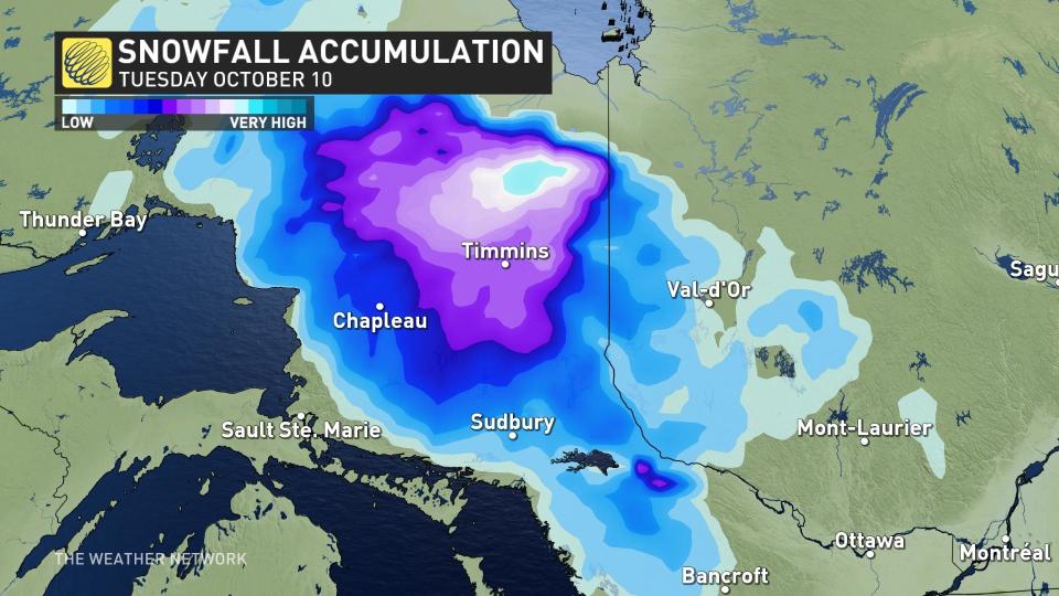
With cold air intensifying a disturbance over Eastern Canada, it’ll be a recipe for wet snow across northern Ontario this upcoming holiday weekend –just a week after all-time, warm October temperatures peppered the region.
*****
Credit belongs to : ca.news.yahoo.com